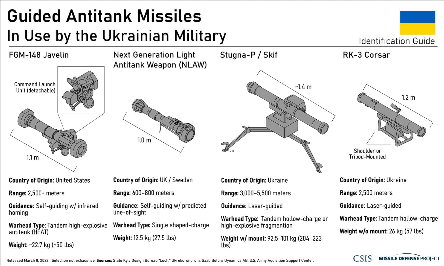
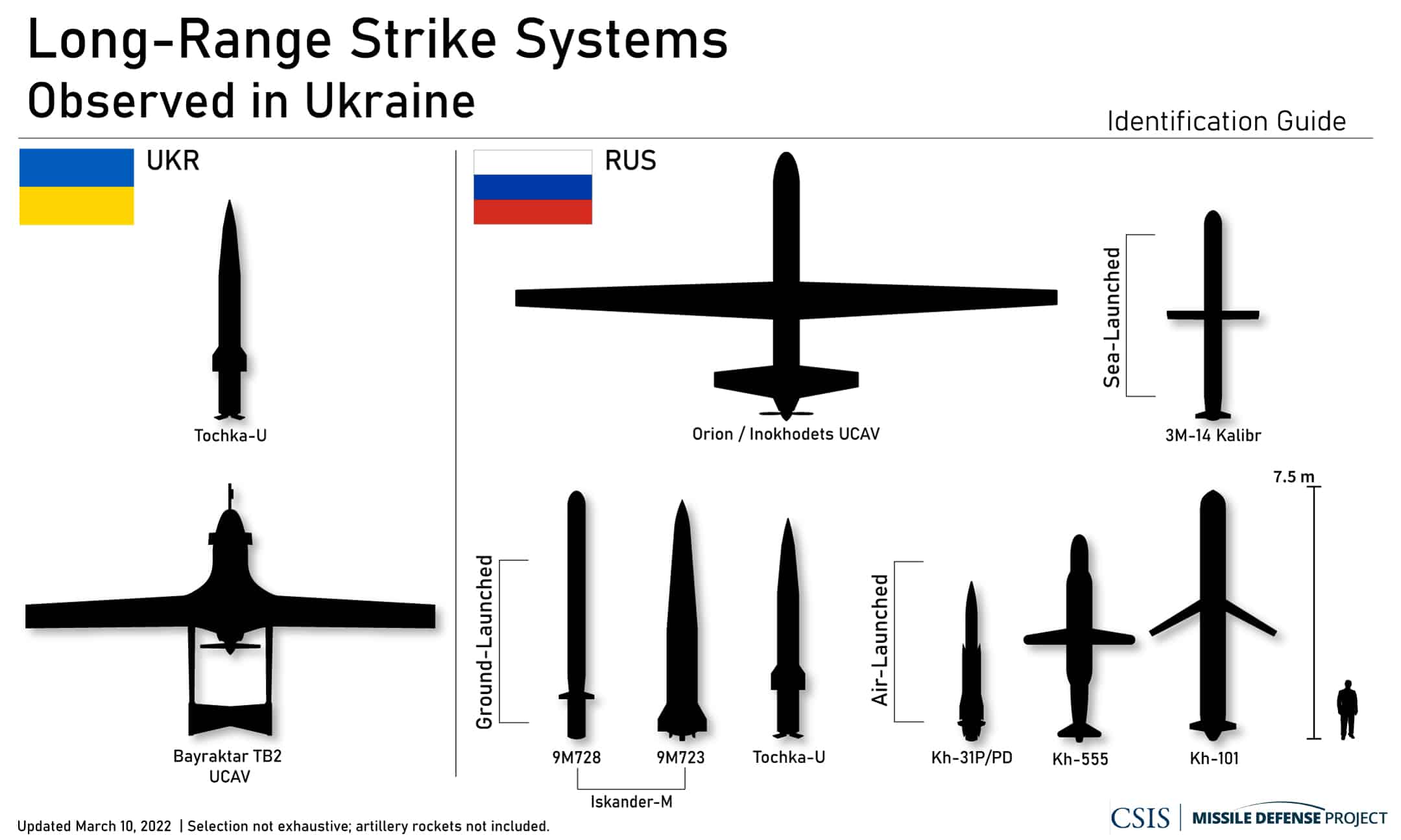
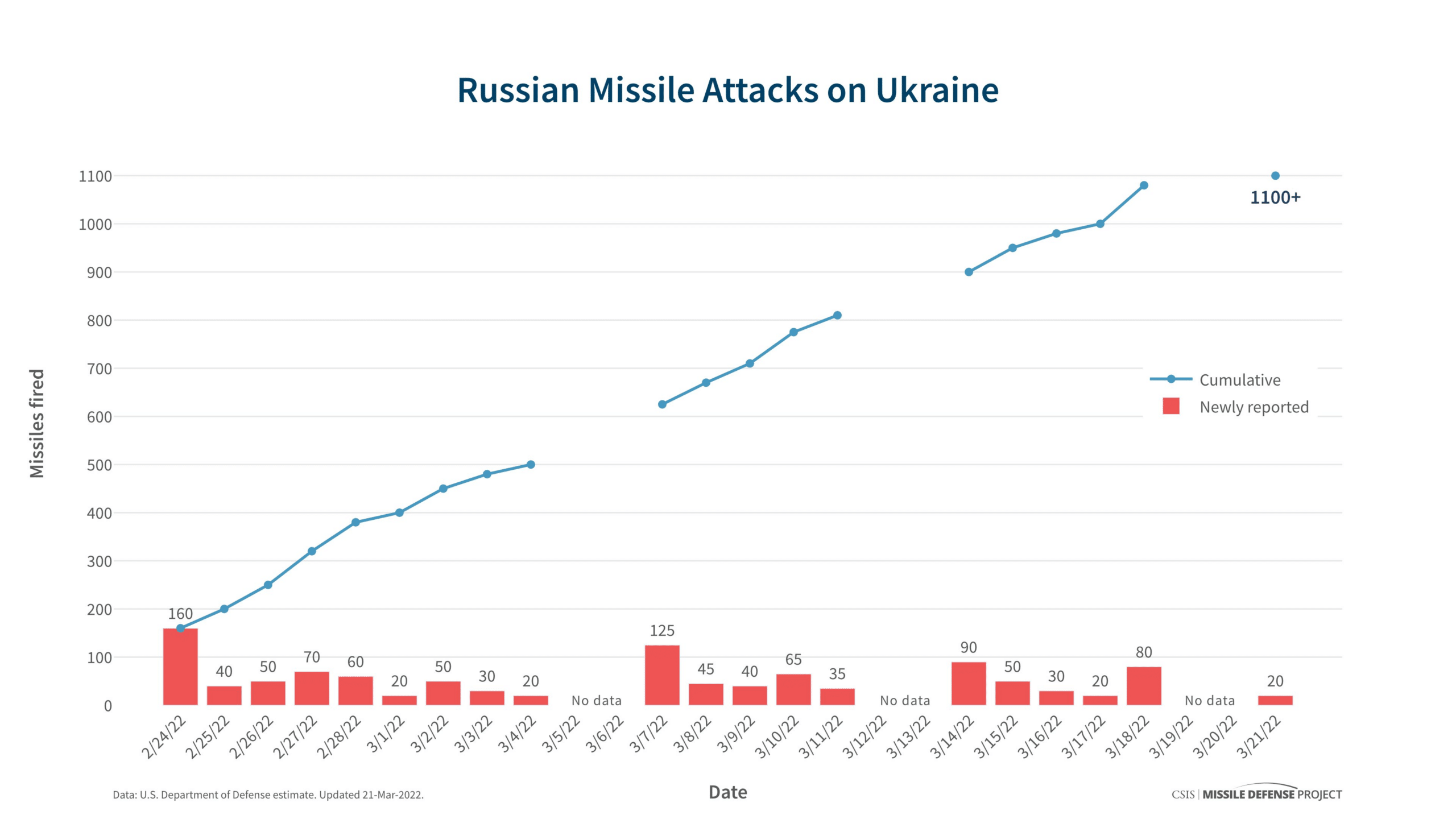
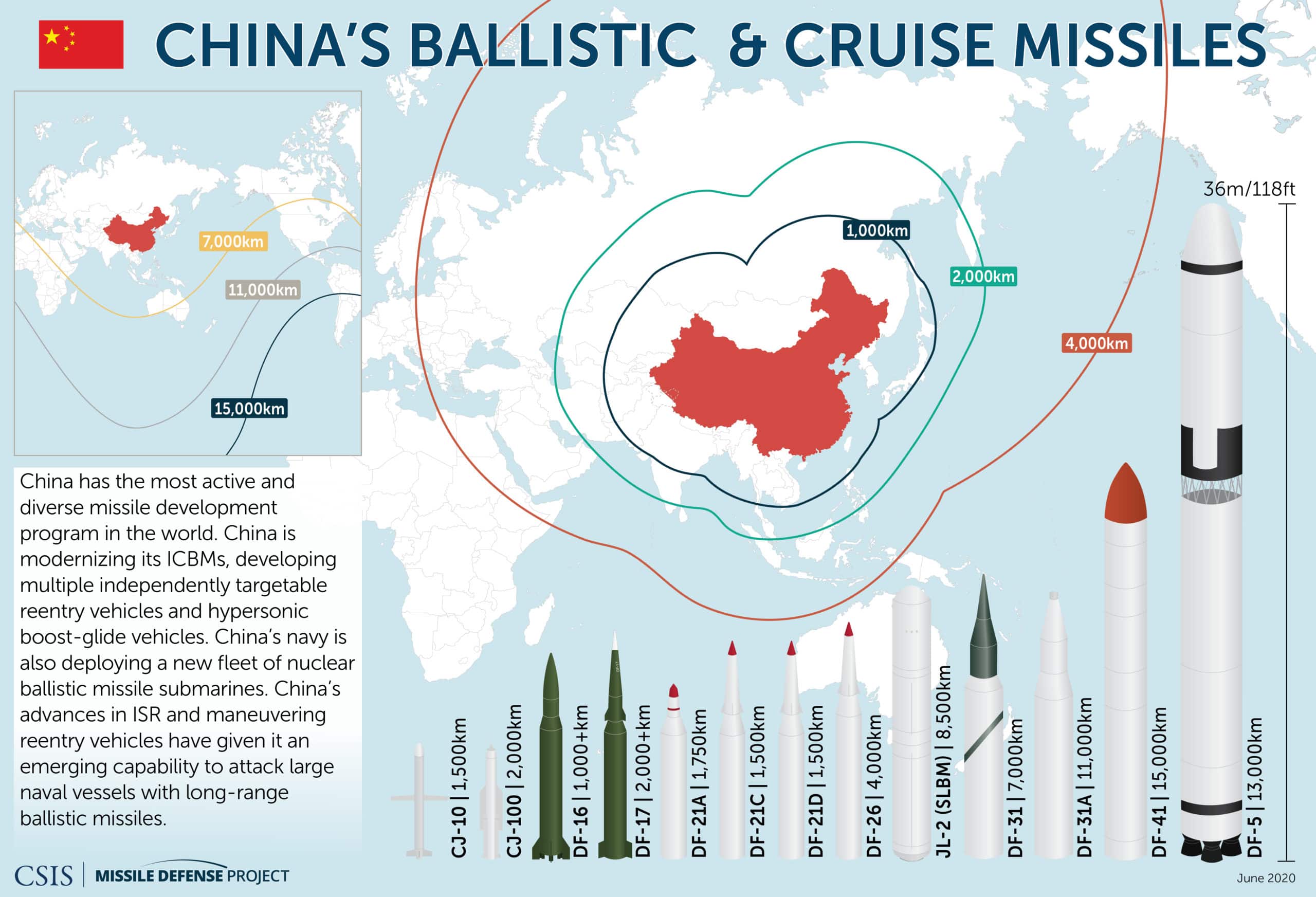
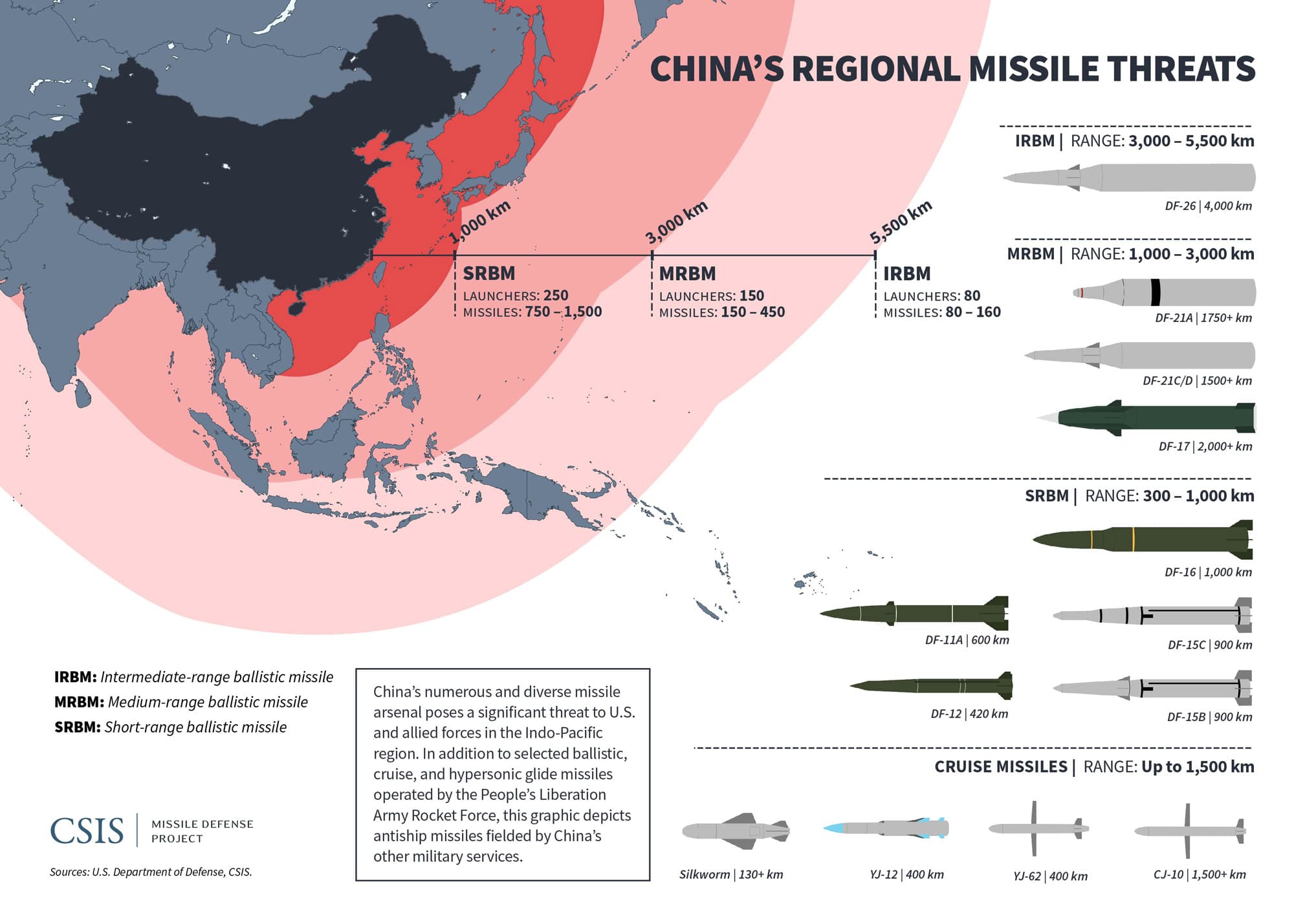
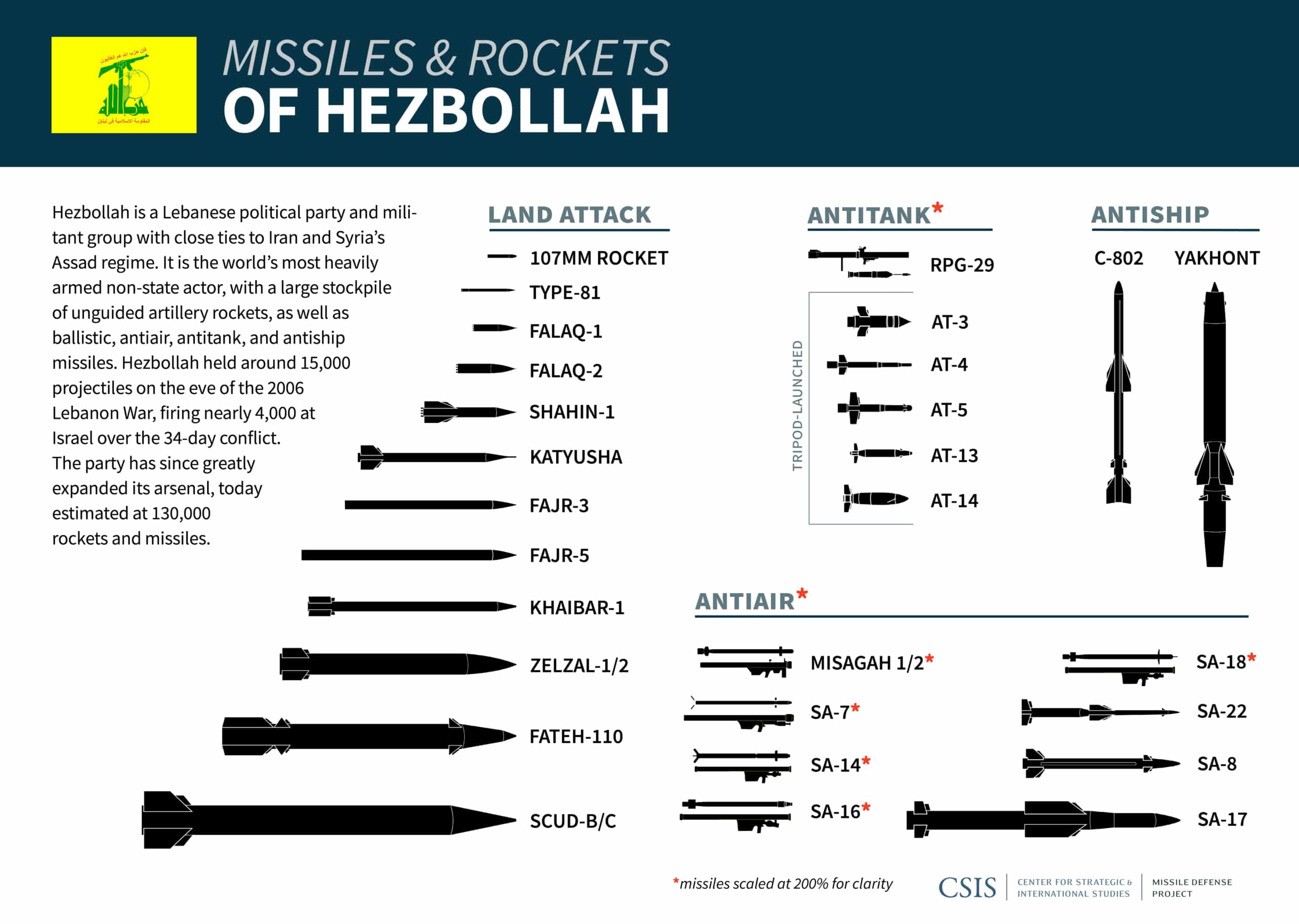
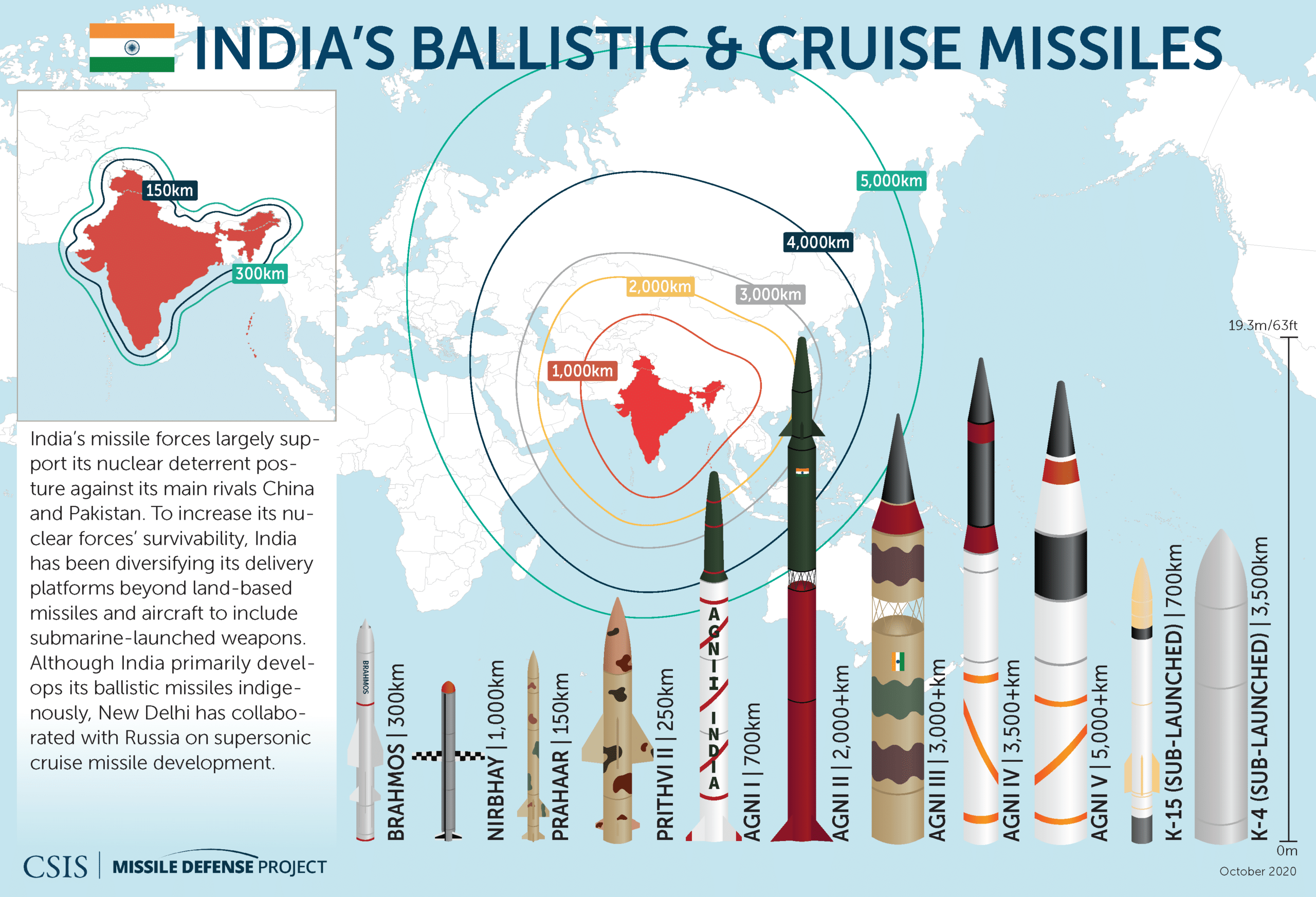
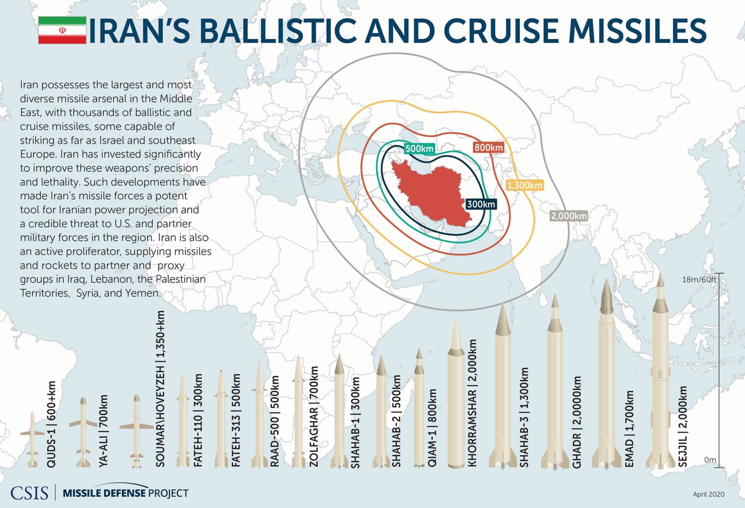
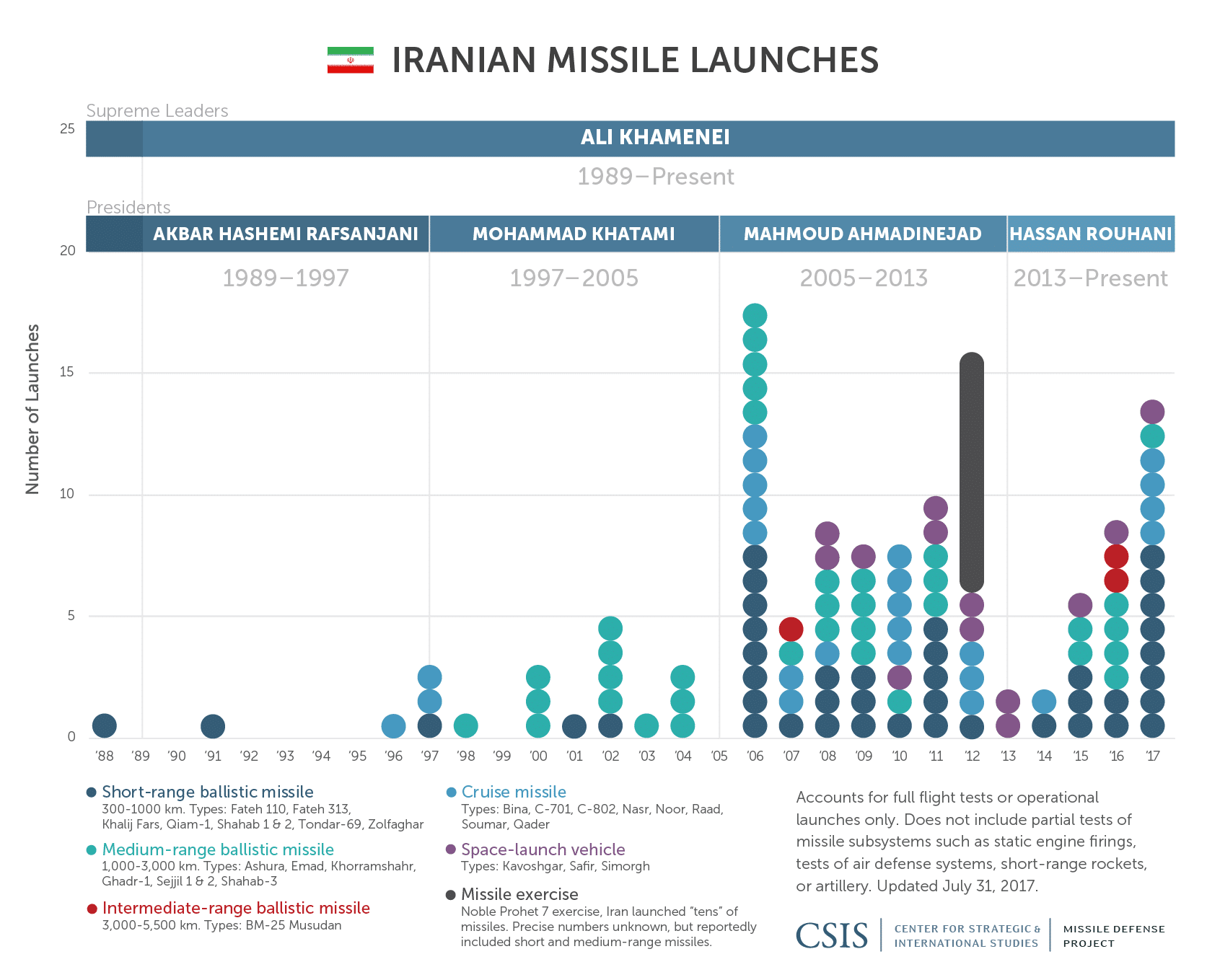
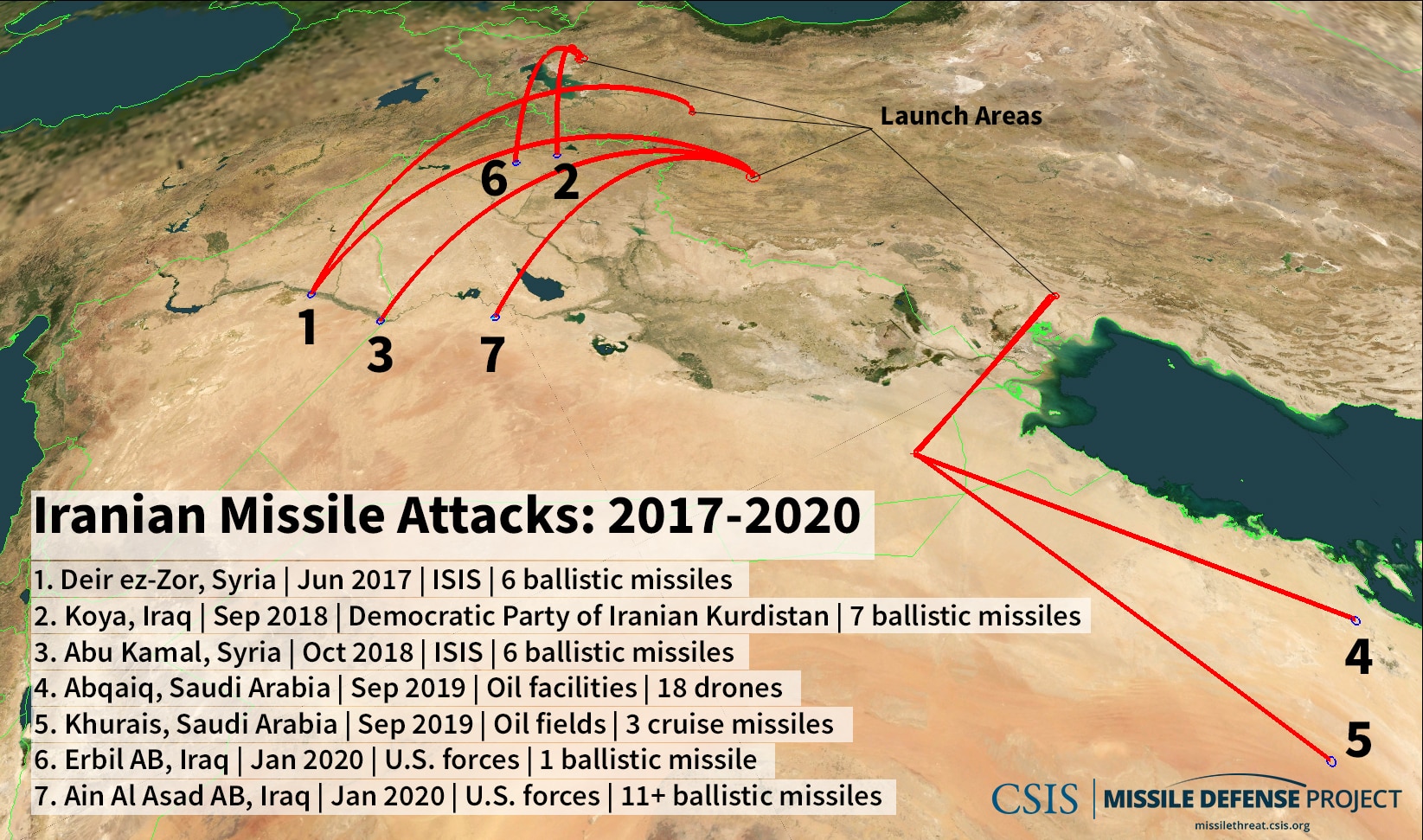
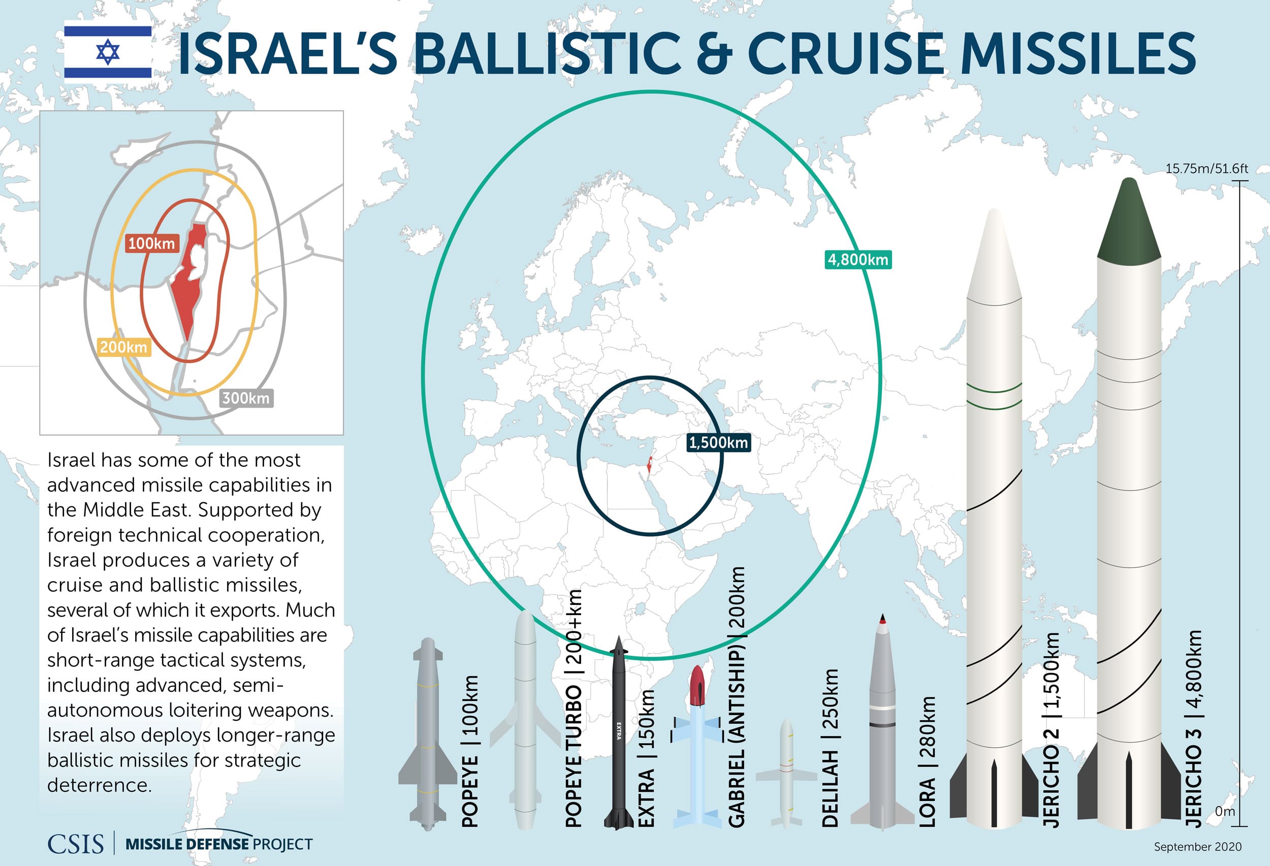
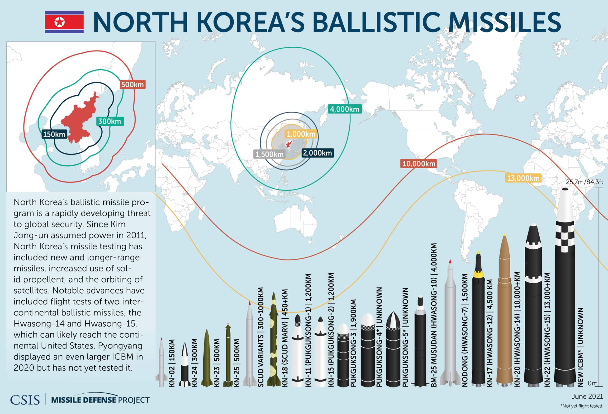
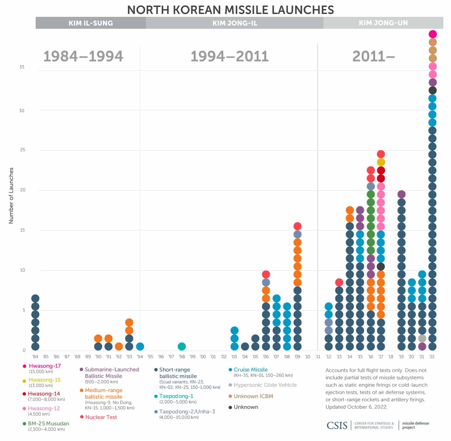
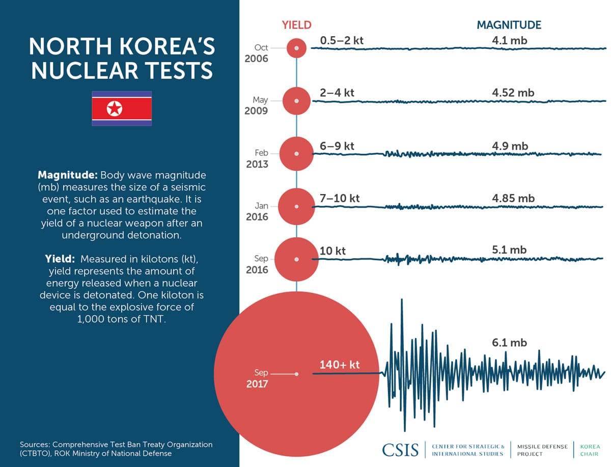
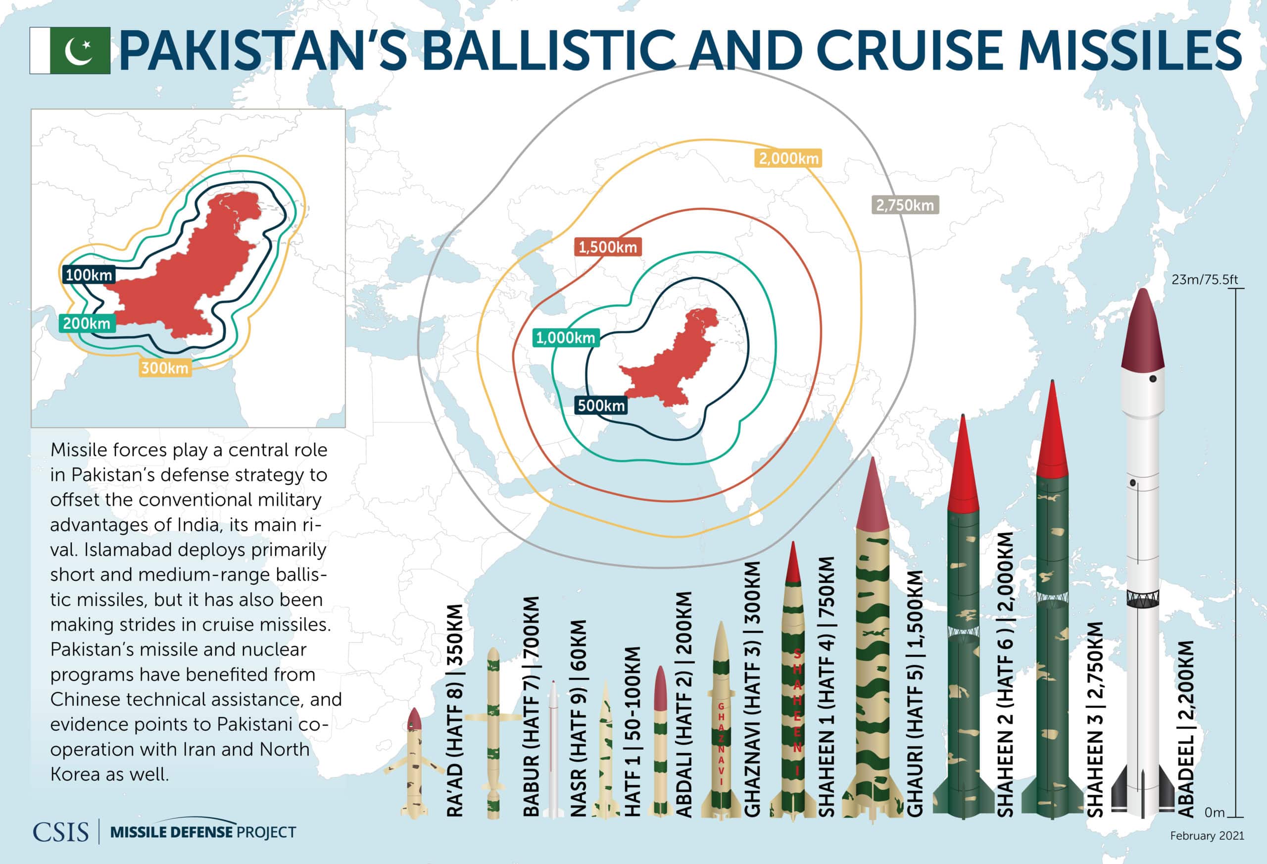
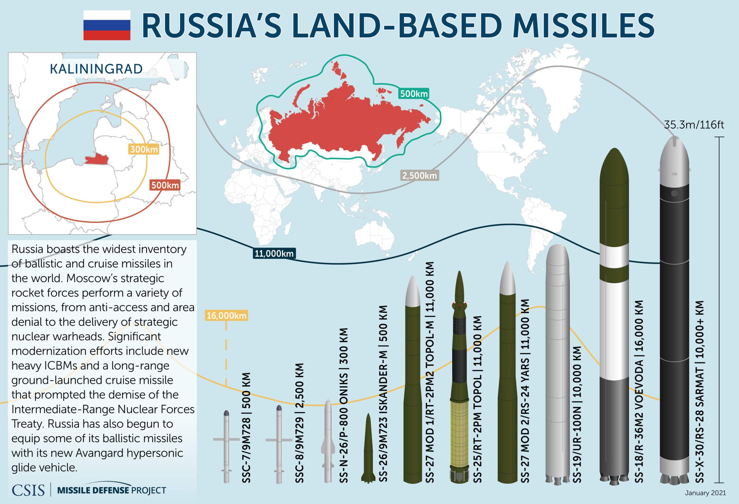
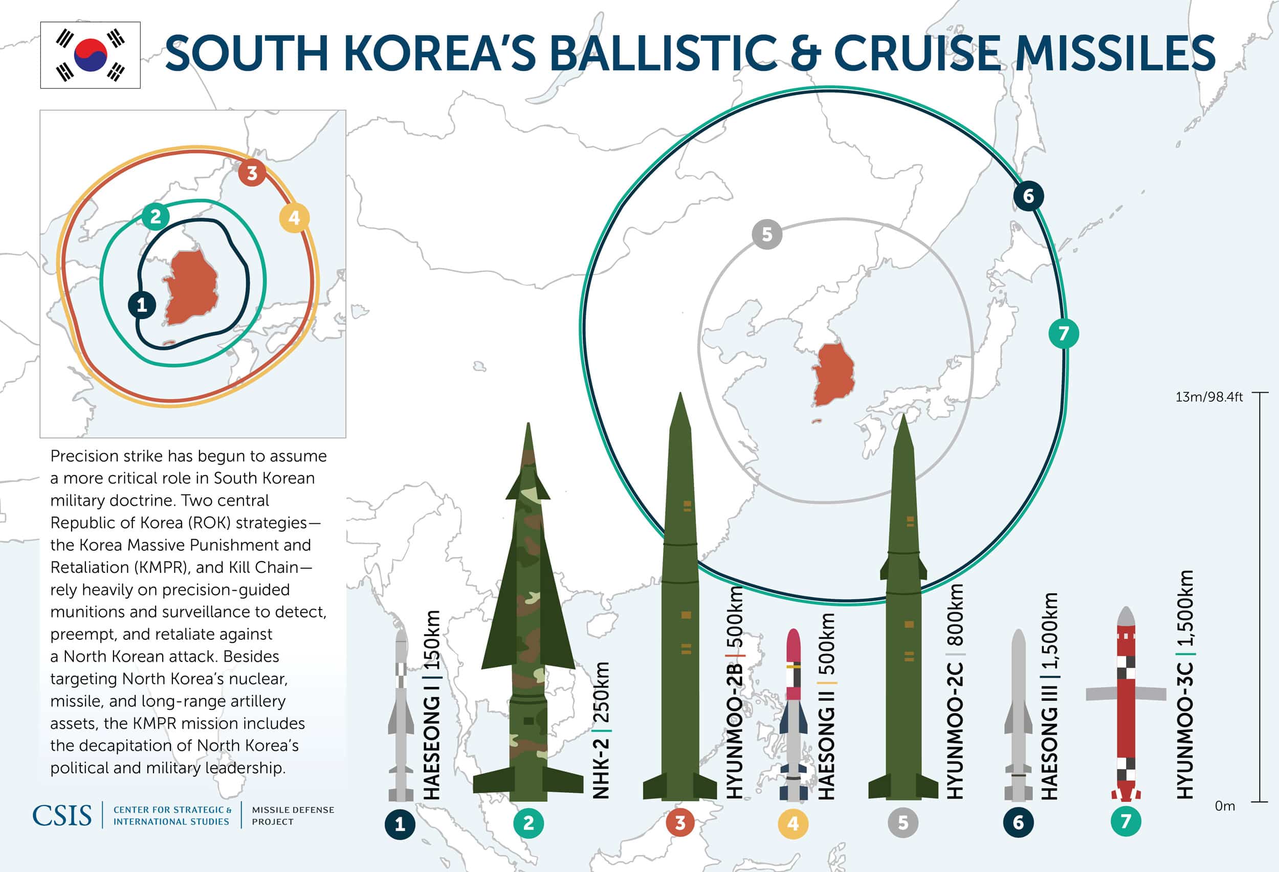
These graphics display the missile activity and capabilities of countries around the globe, including missile ranges, missile testing patterns, and more. All images are free to use with citation to the CSIS Missile Defense Project. Click each image for high resolution.